Tag Archives: northing

How to: convert easting/northing into lat/long for an interactive map

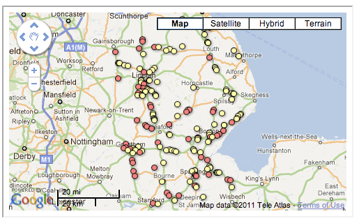
A map generated in Google Fusion Tables from a geocoded dataset
A map generated in Google Fusion Tables from a dataset cleaned using these methods

Google Fusion Tables is great for creating interactive maps from a spreadsheet – but it isn’t too keen on easting and northing. That can be a problem as many government and local authority datasets use easting and northing to describe the geographical position of things – for example, speed cameras.

So you’ll need a way to convert easting and northing into something that Fusion Tables does like – such as latitude and longitude.

Here’s how I did it – quickly. Continue reading

How to: convert easting/northing into lat/long for an interactive map

A map generated in Google Fusion Tables from a geocoded dataset

A map generated in Google Fusion Tables from a dataset cleaned using these methods

Google Fusion Tables is great for creating interactive maps from a spreadsheet – but it isn’t too keen on easting and northing. That can be a problem as many government and local authority datasets use easting and northing to describe the geographical position of things – for example, speed cameras.

So you’ll need a way to convert easting and northing into something that Fusion Tables does like – such as latitude and longitude.

Here’s how I did it – quickly. Continue reading