Tag Archives: Google Maps

“How do I embed a map/video/infographic/audio/timeline/chart/liveblog on WordPress?” Everything you need to know

wordpress logo

Every year one of the questions most frequently asked by journalism students is “How do I embed a map/chart/infographic/liveblog/video/audio/gallery/tweet/document in a WordPress site?”

Here is a comprehensive overview of what is and is not possible in terms of embedding, and what you should do if you cannot embed. Continue reading

Hyperlocal Voices: Matt Brown, Londonist

The fifth in our new series of Hyperlocal Voices explores the work done by the team behind the Londonist. Despite having a large geographic footprint – Londonist covers the whole of Greater London – the site is full of ultra-local content, as well as featuring stories and themes which span the whole of the capital.

Run by two members of staff and a raft of volunteers, Editor Matt Brown gave Damian Radcliffe an insight into the breadth and depth of the site. Continue reading

Maps “in the public interest” now exempt from Google Maps API charge

If you thought you couldn’t use the Google Maps API any more as a journalist, this update to the Google Geo Developers Blog should make you reconsider. From Nieman Journalism Lab:

“Certain web apps will be given blanket exemptions from charging. Here’s Google: “Maps API applications developed by non-profit organisations, applications deemed by Google to be in the public interest, and applications based in countries where we do not support Google Checkout transactions or offer Maps API Premier are exempt from these usage limits.” So nonprofit news orgs look to be in the clear, and Google could declare other news org maps apps to be “in the public interest” and free to run. (It also notes that nonprofits could be eligible for a free Maps API Premier license, which comes with extra goodies around advertising and more.)”

Hyperlocal voices: James Hatts, SE1

This week’s Hyperlocal Voices interview looks at the long-running SE1 website, which boasts half a million visits every month. Despite being over 12 years old, the site remains at the cutting edge of online journalism, being among the first experimenters with the Google Maps API and Audioboo.

Who were the people behind the site, and what were their backgrounds?

The London SE1 website is a family-run enterprise. My father, Leigh Hatts, has a background in outdoors, arts and religious affairs journalism. I was still studying for A-levels when we started the website back in 1998. I went on to study History and Spanish at Royal Holloway, University of London, and continued to run the SE1 website even whilst living and studying in Madrid.

What made you decide to set up the site?

My father was editing a monthly what’s on guide for the City of London (ie the Square Mile) with an emphasis on things that City workers could do in their lunch hour such as attending free lectures and concerts. The publication was funded by the City of London Corporation and in later years by the Diocese of London because many of these events and activities happened in the City churches.

Our own neighbourhood – across the Thames from the City – was undergoing a big change. Huge new developments such as Tate Modern and the London Eye were being planned and built. There was lots of new cultural and community activity in the area, but no-one was gathering information about all of the opportunities available to local residents, workers and visitors in a single place.

In the 1970s and 1980s there was a community newspaper called ‘SE1’ but that had died out, and our neighbourhood was just a small part of the coverage areas of the established local papers (South London Press and Southwark News).

We saw that there was a need for high quality local news and information and decided that together we could produce something worthwhile.

When did you set up the site and how did you go about it?

We launched an ad-funded monthly printed what’s on guide called ‘in SE1’ in May 1998. At the same time we launched a website which soon grew into a product that was distinct from (but complementary to) the printed publication.

The earliest version of the site was hosted on free web space from Tripod (a Geocities rival) and was very basic.

By the end of 1998 we had registered the london-se1.co.uk domain and the site as it is today began to evolve.

In 2001 we moved from flat HTML files to a news CMS called WMNews. We still use a much-customised version. The current incarnation of our forum dates from a similar time, and our events database was developed in 2006.

What other websites influenced you?

When we started there weren’t many local news and community websites.

chiswickw4.com started at about the same time as we did and I’ve always admired it. There used to be a great site for the Paddington area called Newspad (run by Brian Jenner) which was another example of a good hyperlocal site before the term was coined.

More recently I’ve enjoyed following the development at some of the local news and listings sites in the USA, like Pegasus News and Edhat.

I also admire Ventnor Blog for the way it keeps local authorities on their toes.

How did – and do – you see yourself in relation to a traditional news operation?

I think we have quite old-fashioned news values – we place a strong emphasis on local government coverage and the importance of local democracy. That means a lot of evenings sitting in long meetings at Southwark and Lambeth town halls.

Quite often the main difference is simply speed of delivery – why should people wait a week for something to appear in a local paper when we can publish within hours or minutes?

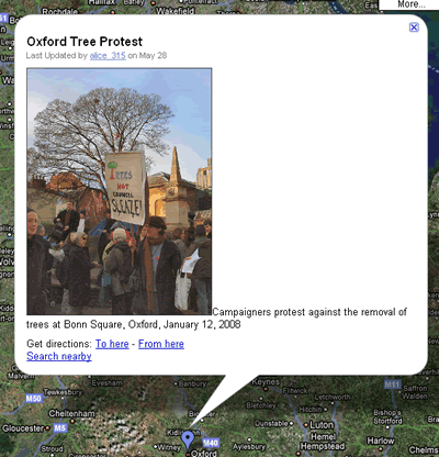
We are able to be much more responsive to changes in technology than traditional news operations – we were one of the first news sites in the UK to integrate the Google Maps API into our content management system, and one of the earliest users of Audioboo.

What have been the key moments in the blog’s development editorially?

It’s very difficult to pinpoint ‘key moments’. I think our success has more to do with quiet persistence and consistency of coverage than any particular breakthrough. Our 12-year track record gives us an advantage over the local papers because their reporters covering our patch rarely last more than a year or two before moving on, so they’re constantly starting again from a clean slate in terms of contacts and background knowledge.

There are also several long-running stories that we’ve followed doggedly for a long time – for example the stop-start saga of the regeneration of the Elephant & Castle area, and various major developments along the riverside.

Twitter has changed things a lot for us, both in terms of newsgathering, and being able to share small bits of information quickly that wouldn’t merit writing a longer article.

Some of the key moments in our 12-year history have been as much about technical achievement as editorial.

In 2006 I developed our CMS for events listings. Since then we have carried details of more than 10,000 local events from jumble sales to public meetings and exhibitions of fine art. As well as powering a large part of the website, this system can also output InDesign tagged text ready to be imported straight onto the pages of our printed publication. How many publications have such an integrated online and print workflow?

What sort of traffic do you get and how has that changed over time?

The site consistently gets more than 500,000 page views a month.

We have a weekly email newsletter which has 7,200 subscribers, and we have about 7,500 followers on Twitter.

For us the big growth in traffic came four or five years ago. Since then there have been steady, unspectacular year-on-year increases in visitor numbers.

A journalistic tour of the Argentinian Bicentenary

On May 25th we celebrate the Argentinian Bicentenary. And while the big media aren’t showing any really interesting initiatives, we have Tu Bicentenario, an independent and experimental journalistic project that aims to give real-time coverage to the main events of the celebrations with social tools and user-collaboration.

With a highly customizable website that integrates different movable boxes, including Facebook, Twitter, YouTube, Vimeo, Google Maps and mobile streaming, they are trying to facilitate the creation and publication of content not only by the creators but by the audience too.

The most interesting content that came out of the project so far -in my opinion- is the survey in pictures and videos of historic sites, contrasted with old images to show the changing of cities. This material is being geolocated in Google Maps.

Some Argentinean Google Maps users also upload 3D models of the most important sights so you can do a virtual tour of the country.

Google Latitude’s Location History provides more opportunities for mobile journalism

This was originally published in Poynter’s E-Media Tidbits last week

Google Latitude – a service that allows people to see where you are – has launched 2 new services – Location History and Location Alerts – that provide some interesting potential for mobile journalism.

location history

Location History (shown above) allows you to “store, view, and manage your past Latitude locations. You can visualize your history on Google Maps and Earth or play back a recent trip in order.”

There are obvious possibilities here for then editing a map with editorial information – if you’re covering a parade, a marathon, or a demonstration you could edit placemarks to add relevant reports as you were posting them (or someone else with access to the account could from the newsroom).

Location Alerts is less obviously useful: this sends you a notification (by email and/or text) when you are near a friend’s location, although as Google explains, it’s a little more clever than that:

“Using your past location history, Location Alerts can recognize your regular, routine locations and not create alerts when you’re at places like home or work. Alerts will only be sent to you and any nearby friends when you’re either at an unusual place or at a routine place at an unusual time. Keep in mind that it may take up to a week to learn your “unusual” locations and start sending alerts.”

There is potential here for making serendipitous contact with readers or contacts, but until Latitude has widespread adoption (its biggest issue for me, and one that may never be resolved), it’s not likely to be useful in the immediate future.

The good thing about Latitude is you can enable it and disable it to suit you, and my own experience is that I only enable it when I want to meet someone using GPS on my phone. To sign up to Google Latitude user, go here. To enable the new features, go to google.com/latitude/apps.

Those are 2 uses I can think of, and I’ve yet to have a serious play – can you think of any others?

US election coverage – who’s making the most of the web?

Elections bring out the best in online journalism. News organisations have plenty of time to plan, there’s a global audience up for grabs, and the material lends itself to interactive treatment (voter opinions; candidates’ stances on various issues; statistics and databases; constant updates; personalisation).

Not only that, but the electorate is using the internet for election news more than any other medium apart from television (and here are some reasons why).

PaidContent has a good roundup of various UK editors’ views, and decides blogs, Twitter and data are the themes (more specifically, liveblogging and mapping). Continue reading

Maps, mashups and multimedia: online journalism students tackle interactivity

Alice Fanning's map of UK eco stories

Alice Fanning's map of UK eco stories

As a new semester begins it seems a good time to finally post about how my second year journalism degree students approached the ‘interactive’ element of their portfolio way back in May (yes, everything they do is interactive, but bear with me).

For the first time I gave them an open brief in terms of what they did interactively (in previous years I asked them to produce Flash interactives). Having been taught how to create everything from audio slideshows and image maps to multimedia interactives, Google Maps and Yahoo! Pipes mashups, I was curious to see what they would pick. Would they all plump for the same option? Continue reading